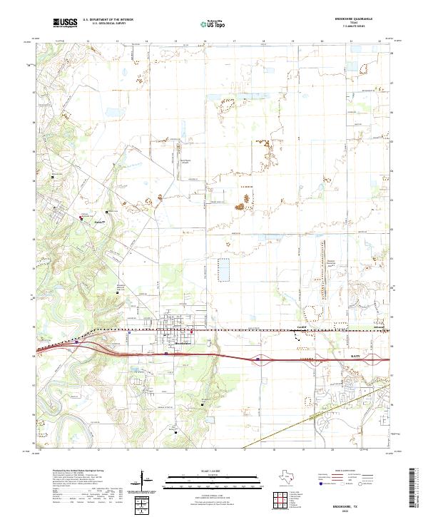
2022 Map of Brookshire
USGS Topo · Published 2022About this map
Brookshire serves as a central hub for this portion of the Texas coastal prairie, situated where the Katy FWY and the historic rail corridor intersect. The landscape is defined by the gentle drainage of Bessies Creek and its many branches, including Bell Bottom Cr and Kellner Cr, which wind through the surrounding ranchlands and agricultural fields. To the north, the smaller settlement of Pattison maintains a distinct identity, anchored by local landmarks like Pattison Methodist Cem and the Pattison Cem.
Find a feature on this map
107 named features on this map. Tap any name to fly to it.
Don’t see what you’re looking for? This feature index may not catch every label — zoom into the map to look around manually.
Map Details
Editions of this 2022 Brookshire Map
This is the sole edition of this map. No revisions or reprints were ever made.
Other maps of this area

1915 · Katy
USGS Topo · 1:24,000

1916 · Swanson
USGS Topo · 1:24,000

1919 · Swanson
USGS Topo · 1:31,680

1950 · Houston
USGS Topo · 1:250,000

1953 · Seguin
USGS Topo · 1:250,000

1955 · Brookshire
USGS Topo · 1:62,500

1955 · Richmond
USGS Topo · 1:62,500

1956 · Sealy
USGS Topo · 1:62,500

1956 · Wallis
USGS Topo · 1:62,500

1956 · Houston
USGS Topo · 1:250,000