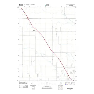
2010 Map of Brookston SW
USGS Topo · Published 2010About this map
Badger Grove and the small crossroads of Cairo anchor this agricultural landscape in northwestern Indiana at the start of the 21st century. The map illustrates a highly organized rural grid, where the movement of water is as carefully managed as the fields themselves, evidenced by several engineered waterways such as Rayman Ditch, Chilton Ditch, and Brown Ditch. These man-made channels support the natural drainage of Burnett Creek and Indian Creek which meander across the township lines. Cultural landmarks like the Cairo Cemetery and the Archibald Memorial Home provide specific points of interest for genealogists tracing local families in this part of White County. The intersection of local county roads and a major divided highway corridor demonstrates the enduring connectivity between these quiet settlements and the larger regional economy.
Find a feature on this map
30 named features on this map. Tap any name to fly to it.
Don’t see what you’re looking for? This feature index may not catch every label — zoom into the map to look around manually.
Map Details
Editions of this 2010 Brookston SW Map
This is the sole edition of this map. No revisions or reprints were ever made.
Other maps of this area

1941 · Lafayette
USGS Topo · 1:24,000

1942 · Otterbein
USGS Topo · 1:24,000

1942 · Lafayette
USGS Topo · 1:24,000

1950 · Lafayette
USGS Topo · 1:24,000

1951 · Otterbein
USGS Topo · 1:24,000

1953 · Danville
USGS Topo · 1:250,000

1955 · Danville
USGS Topo · 1:250,000

1956 · Danville
USGS Topo · 1:250,000

1961 · Lafayette East
USGS Topo · 1:24,000

1961 · Otterbein
USGS Topo · 1:24,000