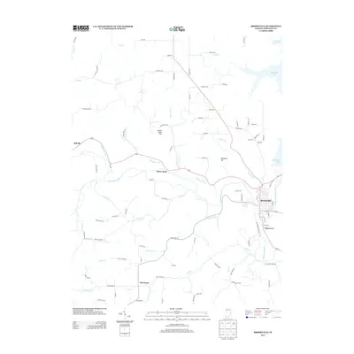
2013 Map of Brookville
USGS Topo · Published 2013About this map
Brookville sits at the confluence of the Whitewater River and the E Fork Whitewater River, serving as a central hub in Franklin County. This landscape is defined by the legacy of early infrastructure, notably the Whitewater Canal which parallels the river through Yellow Bank toward Millville. The geography is shaped by significant elevations such as Yellow Bank Hill and Boundary Hill, while the eastern edge is dominated by the waters of Brookville Lake.
Find a feature on this map
91 named features on this map. Tap any name to fly to it.
Don’t see what you’re looking for? This feature index may not catch every label — zoom into the map to look around manually.
Map Details
Editions of this 2013 Brookville Map
This is the sole edition of this map. No revisions or reprints were ever made.
Other maps of this area

1915 · College Corner
USGS Topo · 1:48,000

1915 · Harrison
USGS Topo · 1:48,000

1918 · College Corner
USGS Topo · 1:62,500

1946 · Batesville
USGS Topo · 1:24,000

1948 · Fairfield
USGS Topo · 1:24,000

1953 · Cincinnati
USGS Topo · 1:250,000

1955 · Mount Carmel
USGS Topo · 1:24,000
1955 · Cedar Grove
USGS Topo · 1:24,000

1956 · Everton
USGS Topo · 1:24,000

1956 · Alpine
USGS Topo · 1:24,000