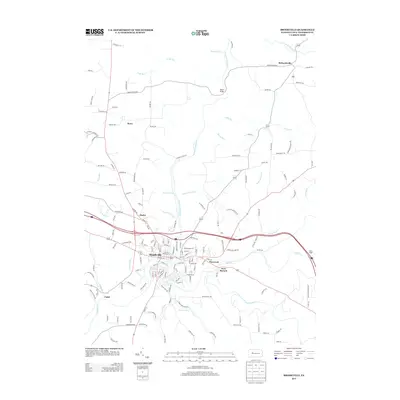
2013 Map of Brookville
USGS Topo · Published 2013About this map
Brookville serves as the central hub of this Jefferson County landscape, situated at the confluence where Redbank Cr and Sandy-Lick Cr meet. The modern infrastructure of Interstate 80 and U.S. Route 322 bisects the region, connecting established communities like Port Barnett and Pinecreek to the east. The map detail reflects a transition from the dense street grids of the borough to the surrounding rural reaches of Richardsville and Howe.
Find a feature on this map
155 named features on this map. Tap any name to fly to it.
Don’t see what you’re looking for? This feature index may not catch every label — zoom into the map to look around manually.
Map Details
Editions of this 2013 Brookville Map
This is the sole edition of this map. No revisions or reprints were ever made.
Other maps of this area

1918 · Loleta
USGS Topo · 1:62,500

1922 · Du Bois
USGS Topo · 1:62,500

1924 · Du Bois
USGS Topo · 1:62,500

1924 · Brookville
USGS Topo · 1:62,500

1926 · Brookville
USGS Topo · 1:62,500

1936 · Marienville
USGS Topo · 1:48,000

1940 · Hallton
USGS Topo · 1:48,000

1941 · Marienville
USGS Topo · 1:62,500

1943 · Hallton
USGS Topo · 1:62,500

1944 · Du Bois
USGS Topo · 1:62,500
Featured Places
- Brookville, PA
- Warsaw Township, PA
- Knox Township, PA
- Pine Creek Township, PA
- Richardsville, Warsaw Township