2023 Map of Brookville
USGS Topo · Published 2023About this map
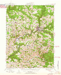
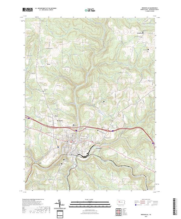
The Jefferson County Courthouse stands at the heart of Brookville, anchoring a landscape where the North Fork Redbank Creek and Sandy Lick Creek converge to form Redbank Creek. This 2023 survey illustrates a modern community deeply connected to its origins, with numerous cemeteries like the Old Brookville Cem and Saint Marys Catholic Cem Original preserving the names of early generations. The rugged topography of the Allegheny Plateau is evident in the winding courses of Fivemile Run and Yeomans Run, while the Redbank Valley Trl repurposes the historic transportation corridors that once drove the local economy. Smaller settlements such as Richardsville, Alaska, and Port Barnett dot the surrounding highlands, connected by a network of rural roads that follow the ridges and valleys of Creek Hollow Ridge.
Find a feature on this map
109 named features on this map. Tap any name to fly to it.
Don’t see what you’re looking for? This feature index may not catch every label — zoom into the map to look around manually.
Map Details
Editions of this 2023 Brookville Map
This is the sole edition of this map. No revisions or reprints were ever made.
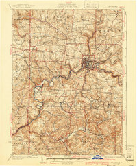
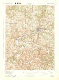
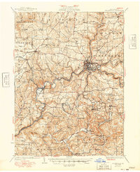
Historical Maps of Union Township Through Time
6 maps found