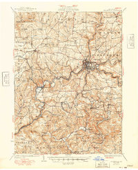
1949 Map of Brookville
USGS Topo · Published 1949About this map
Brookville sits at the confluence of North Fork, Sandy Lick Creek, and Redbank Creek, serving as a central hub for the Pennsylvania and Pittsburg and Shawmut railroads. The late 1940s landscape is defined by a dense network of rural schoolhouses, such as Hazel Dell School, Orr Hill School, and Beech Hollow School, reflecting the decentralized community structure of Jefferson County at this time. To the south, mining and small-scale agriculture support settlements like Conifer, Knoxdale, and Ramsaytown. The terrain is characterized by steep valleys carved by waterways like Mill Creek and Little Sandy Creek, which historically dictated the placement of rail lines and early road networks. Local religious life is anchored by landmarks like Mead Chapel and Zion Church, which remain key touchstones for genealogical research in this region.
Find a feature on this map
96 named features on this map. Tap any name to fly to it.
Don’t see what you’re looking for? This feature index may not catch every label — zoom into the map to look around manually.
Map Details
Editions of this 1949 Brookville Map
This is the sole edition of this map. No revisions or reprints were ever made.
Other maps of this area

1901 · Rural Valley
USGS Topo · 1:62,500

1903 · Rural Valley
USGS Topo · 1:62,500

1906 · Clarion
USGS Topo · 1:62,500

1906 · Punxsutawney
USGS Topo · 1:62,500

1907 · Clarion
USGS Topo · 1:62,500

1909 · Smicksburg
USGS Topo · 1:62,500

1918 · Loleta
USGS Topo · 1:62,500

1922 · Tionesta
USGS Topo · 1:62,500

1922 · Du Bois
USGS Topo · 1:62,500

1924 · Du Bois
USGS Topo · 1:62,500