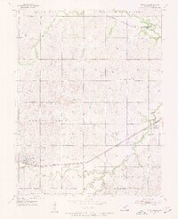
1955 Map of Brookville
USGS Topo · Published 1956About this map
Brookville serves as a primary settlement in this central Kansas landscape, where the agricultural plains are bisected by two major rail lines. The Union Pacific runs through the southern reaches of the quadrangle, passing through Bavaria, while the Atchison Topeka and Santa Fe skirts the northern edge near Hedville. This mid-century survey reveals a transition in land use, as the southern border is defined by the Smoky Hill Air Force Base Bombing Range, a significant military footprint adjacent to the winding path of West Spring Creek. Local history is preserved in the location of the Brookville Cem and Calvary Cem, situated near the town center. The drainage patterns of Spring Creek, Mulberry Creek, and Elm Creek illustrate the riparian corridors that break the geometric grid of section lines and township boundaries like Glendale and Ohio.
Find a feature on this map
19 named features on this map. Tap any name to fly to it.
Don’t see what you’re looking for? This feature index may not catch every label — zoom into the map to look around manually.
Map Details
Editions of this 1955 Brookville Map
3 editions found
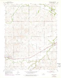
Other maps of this area

1892 · Salina
USGS Topo · 1:125,000

1942 · Salina
USGS Topo · 1:125,000

1955 · Salina SW
USGS Topo · 1:24,000

1955 · Trenton
USGS Topo · 1:24,000

1955 · Smolan
USGS Topo · 1:24,000

1955 · Brookville
USGS Topo · 1:24,000

1955 · Culver
USGS Topo · 1:24,000

1955 · Falun
USGS Topo · 1:24,000

1955 · Hutchinson
USGS Topo · 1:250,000

1957 · Brookville SW
USGS Topo · 1:24,000