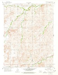
1957 Map of Brookville SW
USGS Topo · Published 1978About this map
Mulberry Creek winds through the northern half of this central Kansas landscape, where rural community life was anchored by the Mulberry Sch, Mulberry Ch, and Mulberry Cem. These features reflect a traditional settlement pattern centered on local townships like Madison, Mulberry, and Carneiro. To the south, the Union Pacific railroad corridor cuts across the terrain, serving small sidings and stops such as Arcola.
Find a feature on this map
18 named features on this map. Tap any name to fly to it.
Don’t see what you’re looking for? This feature index may not catch every label — zoom into the map to look around manually.
Map Details
Editions of this 1957 Brookville SW Map
3 editions found
Other maps of this area

1892 · Salina
USGS Topo · 1:125,000

1894 · Ellsworth
USGS Topo · 1:125,000

1942 · Salina
USGS Topo · 1:125,000

1955 · Brookville
USGS Topo · 1:24,000

1955 · Culver
USGS Topo · 1:24,000

1955 · Falun
USGS Topo · 1:24,000

1955 · Great Bend
USGS Topo · 1:250,000

1955 · Hutchinson
USGS Topo · 1:250,000

1957 · Great Bend
USGS Topo · 1:250,000

1957 · Brookville SW
USGS Topo · 1:24,000