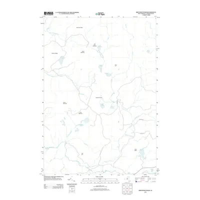
2013 Map of Brother Ponds
USGS Topo · Published 2013About this map
The S Br Grass River winds through this heavily forested and water-bound section of Saint Lawrence County, New York. This high-resolution survey captures a landscape defined by its glacial heritage, characterized by numerous small bodies of water such as the Brother Ponds, Pleasant Lake, and Sampson Pond. The terrain is marked by distinct ridges and peaks, including Potter Mountain, Wilson Mountain, and Buckhorn Ridge, providing a clear view of the drainage patterns for Stony Brook and Dead Cr. Human infrastructure is minimal, represented by a few remote arteries like The Bog Rd and Windfall Rd. The map illustrates a wilderness character where landforms like Hardwood Island and Wolf Ridge rise above the surrounding wetlands and ponds, reflecting the enduring environmental character of the North Country in the early 21st century.
Find a feature on this map
35 named features on this map. Tap any name to fly to it.
Don’t see what you’re looking for? This feature index may not catch every label — zoom into the map to look around manually.
Map Details
Editions of this 2013 Brother Ponds Map
This is the sole edition of this map. No revisions or reprints were ever made.
Other maps of this area

1907 · Tupper Lake
USGS Topo · 1:62,500

1919 · Cranberry Lake
USGS Topo · 1:62,500

1920 · Childwold
USGS Topo · 1:62,500

1921 · Cranberry Lake
USGS Topo · 1:62,500

1921 · Childwold
USGS Topo · 1:48,000

1921 · Stark
USGS Topo · 1:62,500

1922 · Childwold
USGS Topo · 1:62,500

1923 · Stark
USGS Topo · 1:62,500

1931 · Cranberry Lake
USGS Topo · 1:62,500

1940 · Stark
USGS Topo · 1:62,500