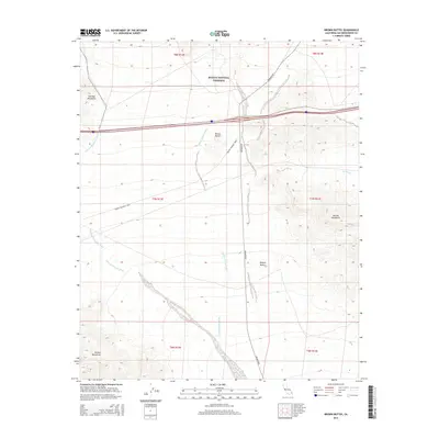
2015 Map of Brown Buttes
USGS Topo · Published 2015About this map
The Mojave National Preserve covers the northern portion of this arid landscape, where the high desert terrain is defined by dramatic volcanic and mountain formations. Central to the topography are the Brown Buttes, situated between the Old Dad Mountains to the northwest and the Marble Mountains to the east. This 2015 survey illustrates the complex drainage patterns of the Mojave Desert, where seasonal water moves through expansive networks such as the Old Dad Mountains Wash and the Orange Blossom Wash.
Find a feature on this map
18 named features on this map. Tap any name to fly to it.
Don’t see what you’re looking for? This feature index may not catch every label — zoom into the map to look around manually.
Map Details
Editions of this 2015 Brown Buttes Map
This is the sole edition of this map. No revisions or reprints were ever made.
Other maps of this area

1942 · Amboy
USGS Topo · 1:250,000

1943 · Amboy
USGS Topo · 1:250,000

1954 · Needles
USGS Topo · 1:250,000

1954 · Amboy Crater
USGS Topo · 1:24,000

1956 · Needles
USGS Topo · 1:250,000

1956 · Cadiz
USGS Topo · 1:62,500
1956 · Bagdad
USGS Topo · 1:62,500

1956 · Flynn
USGS Topo · 1:62,500
1957 · Kerens
USGS Topo · 1:62,500
1960 · Bagdad
USGS Topo · 1:50,000