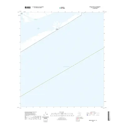
2022 Map of Brown Cedar Cut
USGS Topo · Published 2022About this map
Matagorda Peninsula forms a narrow barrier between the open waters of the Gulf of Mexico and the protected marshes of East Matagorda Bay. This coastal landscape is defined by the vital transit of the Intracoastal Waterway, which cuts through the northern reach of the bay near Turkey Island and Live Oak Bay. The map highlights the dynamic nature of this shoreline, specifically the tidal inlet at Brown Cedar Cut, a critical point of exchange between the bay and the sea. The absence of permanent road infrastructure or settlements emphasizes the remote, maritime character of this stretch of the Texas coast, where the geography is shaped entirely by wind, tide, and the engineered needs of coastal navigation.
Find a feature on this map
7 named features on this map. Tap any name to fly to it.
Don’t see what you’re looking for? This feature index may not catch every label — zoom into the map to look around manually.
Map Details
Editions of this 2022 Brown Cedar Cut Map
This is the sole edition of this map. No revisions or reprints were ever made.
Other maps of this area

1951 · Bay City
USGS Topo · 1:250,000

1952 · Lake Austin
USGS Topo · 1:24,000

1952 · Dressing Point
USGS Topo · 1:24,000

1952 · Cedar Lakes West
USGS Topo · 1:24,000
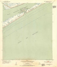
1952 · Brown Cedar Cut
USGS Topo · 1:24,000

1952 · Sargent
USGS Topo · 1:24,000

1956 · Bay City
USGS Topo · 1:250,000

1958 · Bay City
USGS Topo · 1:250,000
1974 · Bay City
USGS Topo · 1:250,000
2010 · Sargent
USGS Topo · 1:24,000