Loading...
Loading map...2023 Map of Brown City
USGS Topo · Published 2023About this map
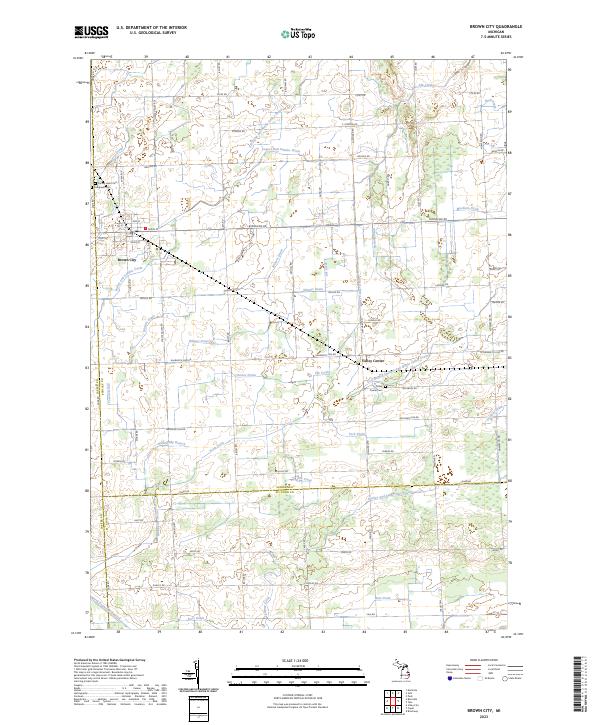
Brown City occupies the northwestern corner of this landscape, situated where the borders of Sanilac and Lapeer counties meet. The surrounding terrain is defined by a dense network of agricultural drainage systems, including the Lapeer and Sanilac Drain and the Elk Flynn and Maple Valley Drain, reflecting the area's intensive land management for farming. These waterways feed into Elk Creek and the North Branch Mill Creek at the southern edge of the quadrangle.
Find a feature on this map
78 named features on this map. Tap any name to fly to it.
Don’t see what you’re looking for? This feature index may not catch every label — zoom into the map to look around manually.
Map Details
Date Portrayed2023
Date Published2023
PublisherU.S. Geological Survey
Map TypeTopographic
Scale1:24000
Physical Dimensions24 x 29 inches
Editions of this 2023 Brown City Map
This is the sole edition of this map. No revisions or reprints were ever made.
Historical Maps of Valley Center Through Time
Featured Locations
Source Details
SourceU.S. Geological Survey
CopyrightPublic Domain