
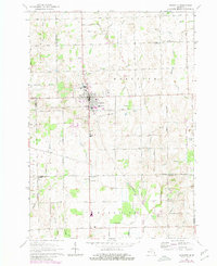
1963 Map of Marlette
USGS Topo · Published 1964About this map
The town of Marlette serves as the central hub for this agricultural region during the early 1960s, situated at the intersection of the Chesapeake and Ohio railroad and several key transport arteries. The surrounding landscape in Sanilac, Tuscola, and Lapeer counties is defined by a dense network of drainage systems, such as White and Moffatt Drain and Sullivan Drain, which support the intensive farming character of the area. Rural social life is anchored by institutions like the French Line Presbyterian Ch, Haper Community Hall, and several local schools including McDonald Sch and Montgomery Sch.
Find a feature on this map
59 named features on this map. Tap any name to fly to it.
Don’t see what you’re looking for? This feature index may not catch every label — zoom into the map to look around manually.
Map Details
Editions of this 1963 Marlette Map
2 editions found
Other maps of this area

1954 · Flint
USGS Topo · 1:250,000

1958 · Flint
USGS Topo · 1:250,000

1961 · Brown City
USGS Topo · 1:24,000

1963 · Snover
USGS Topo · 1:24,000

1963 · Clifford
USGS Topo · 1:24,000

1963 · Juhl
USGS Topo · 1:24,000

1963 · North Branch
USGS Topo · 1:24,000

1963 · Kingston
USGS Topo · 1:24,000

1963 · Burnside
USGS Topo · 1:24,000
1963 · Decker
USGS Topo · 1:24,000