
1963 Map of North Branch
USGS Topo · Published 1964About this map
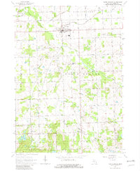
The village of North Branch serves as the focal point of this Lapeer County landscape in the early 1960s, situated where the Flint River begins to wind through fertile agricultural lands. The map details a transition from the structured township grids of Burlington and Rich to the more varied terrain of the Lapeer State Game Area in the south. This southern portion is characterized by a dense cluster of water bodies, including Norway Lake, Bear Lake, and Gravel Lake, reflecting a glacial geology that contrasts with the drainage systems of the north, such as the Sutter and Eight Line Drain.
Find a feature on this map
69 named features on this map. Tap any name to fly to it.
Don’t see what you’re looking for? This feature index may not catch every label — zoom into the map to look around manually.
Map Details
Editions of this 1963 North Branch Map
2 editions found
Other maps of this area

1954 · Flint
USGS Topo · 1:250,000

1958 · Flint
USGS Topo · 1:250,000

1963 · Clifford
USGS Topo · 1:24,000

1963 · Attica
USGS Topo · 1:24,000

1963 · Mayville
USGS Topo · 1:24,000

1963 · Marlette
USGS Topo · 1:24,000

1963 · Burnside
USGS Topo · 1:24,000
1963 · Imlay City
USGS Topo · 1:24,000
1963 · Barnes Lake
USGS Topo · 1:24,000
1963 · Lapeer
USGS Topo · 1:24,000