
1963 Map of Attica
USGS Topo · Published 1964About this map
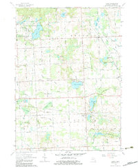
The Lapeer State Game Area dominates the northwestern portion of this Lapeer County landscape, preserving a network of glacial water bodies including Fish Lake and Long Lake. This mid-century survey reveals a rural Michigan community centered on small hubs like Attica and Lum, connected by a dense grid of township roads. The topography is defined by its complex drainage systems, with dozens of named artificial and natural channels like Elgin Drain and Brant Drain crisscrossing the townships of Mayfield, Arcadia, and Attica. Local social structures are well-preserved through the inclusion of several district schoolhouses, such as Griswold Sch and Youngs Sch, and the presence of Beulah Ch. While recreation is evident at the Arcadia Hills Golf Club and Roadside Park, the map's fine red dashed lines also indicate field and fence lines, offering a glimpse into the agricultural boundaries of the era.
Find a feature on this map
77 named features on this map. Tap any name to fly to it.
Don’t see what you’re looking for? This feature index may not catch every label — zoom into the map to look around manually.
Map Details
Editions of this 1963 Attica Map
2 editions found
Other maps of this area

1943 · Metamora
USGS Topo · 1:24,000

1945 · Almont
USGS Topo · 1:24,000

1945 · Thornville
USGS Topo · 1:24,000

1946 · Metamora
USGS Topo · 1:24,000

1954 · Detroit
USGS Topo · 1:250,000

1954 · Flint
USGS Topo · 1:250,000

1958 · Flint
USGS Topo · 1:250,000

1961 · Detroit
USGS Topo · 1:250,000

1963 · North Branch
USGS Topo · 1:24,000

1963 · Burnside
USGS Topo · 1:24,000