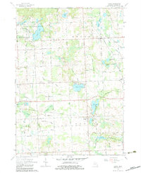
1963 Map of Attica
USGS Topo · Published 1983About this map
The Grand Trunk railroad serves as a central artery through this 1960s landscape, connecting the small lakeside settlements of Attica and Lum. The terrain is defined by a dense network of drainage channels such as Elk Lake Drain and Sickles Drain, supporting the agricultural and recreational life of eastern Lapeer County. Several rural schoolhouses, including Fish Lake Sch, Youngs Sch, and Buckingham Sch, reflect a community structure still rooted in local districts before modern consolidation.
Find a feature on this map
57 named features on this map. Tap any name to fly to it.
Don’t see what you’re looking for? This feature index may not catch every label — zoom into the map to look around manually.
Map Details
Editions of this 1963 Attica Map
2 editions found
Other maps of this area

1943 · Metamora
USGS Topo · 1:24,000

1945 · Almont
USGS Topo · 1:24,000

1945 · Thornville
USGS Topo · 1:24,000

1946 · Metamora
USGS Topo · 1:24,000

1954 · Detroit
USGS Topo · 1:250,000

1954 · Flint
USGS Topo · 1:250,000

1958 · Flint
USGS Topo · 1:250,000

1961 · Detroit
USGS Topo · 1:250,000

1963 · Attica
USGS Topo · 1:24,000

1963 · North Branch
USGS Topo · 1:24,000