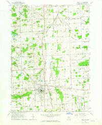
1963 Map of Imlay City
USGS Topo · Published 1964About this map
Imlay City serves as the focal point of this 1963 survey, where the Grand Trunk Railroad intersects the local road network and provides access to the municipal Fairground and Mt Calvary Cem. The landscape is characterized by an extensive system of agricultural drainage, with features like Madison Drain and Kohler Drain supporting the rural economy of Goodland and Clarks Corner. Small rural schoolhouses, such as Cole Sch and Sheppard Sch, are scattered throughout the quadrangle, reflecting a distributed farming community that relied on these local institutions before later consolidation. The presence of several Gravel Pits along the North Branch Belle River suggests local industry geared toward road building and construction during this era of Michigan's development.
Find a feature on this map
69 named features on this map. Tap any name to fly to it.
Don’t see what you’re looking for? This feature index may not catch every label — zoom into the map to look around manually.
Map Details
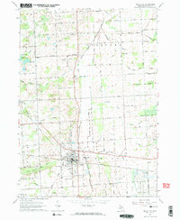
Editions of this 1963 Imlay City Map
2 editions found
Other maps of this area

1914 · Armada
USGS Topo · 1:62,500

1928 · Armada
USGS Topo · 1:62,500

1945 · Almont
USGS Topo · 1:24,000

1945 · Allenton
USGS Topo · 1:24,000

1945 · Thornville
USGS Topo · 1:24,000

1952 · Allenton
USGS Topo · 1:24,000

1954 · Detroit
USGS Topo · 1:250,000

1954 · Flint
USGS Topo · 1:250,000

1958 · Flint
USGS Topo · 1:250,000

1961 · Brown City
USGS Topo · 1:24,000