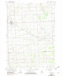
1961 Map of Brown City
USGS Topo · Published 1982About this map
Brown City serves as the primary hub for this agricultural landscape, where the Chesapeake and Ohio railroad corridor cuts northwest through the heart of the thumb region. This 1961 survey, photoinspected in the late 1970s, captures a transition point in rural infrastructure, marked by a dense network of county-line drains and a distribution of local schoolhouses such as Hill Sch, Odelville Sch, and Sharpsville Sch. The terrain is defined by the Maple Valley and the intricate water management of the Lapeer and Sanilac Drain and Elk Drain. Genealogists will find significant detail in the placement of community anchors like St Marys Cem, Evergreen Cem, and the Mennonite Ch. Small stops and vanished place names like Winters, Witmer, and Varney offer clues to the earlier settlement patterns and rural economy of Sanilac, Lapeer, and St. Clair counties.
Find a feature on this map
61 named features on this map. Tap any name to fly to it.
Don’t see what you’re looking for? This feature index may not catch every label — zoom into the map to look around manually.
Map Details
Editions of this 1961 Brown City Map
2 editions found
Other maps of this area

1954 · Flint
USGS Topo · 1:250,000

1958 · Flint
USGS Topo · 1:250,000

1961 · Brown City
USGS Topo · 1:24,000
1961 · Brockway
USGS Topo · 1:24,000

1961 · Yale
USGS Topo · 1:24,000
1961 · Capac
USGS Topo · 1:24,000

1963 · Peck
USGS Topo · 1:24,000

1963 · Juhl
USGS Topo · 1:24,000

1963 · Marlette
USGS Topo · 1:24,000

1963 · Burnside
USGS Topo · 1:24,000