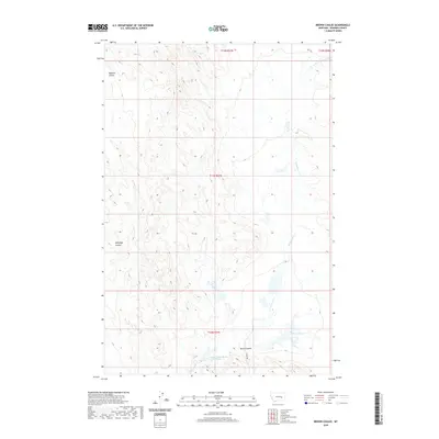
2020 Map of Brown Coulee
USGS Topo · Published 2020About this map
Lower Blacktail Reservoir sits at the southern edge of this landscape, fed by the seasonal drainage of E Blacktail Cr. This part of Rosebud County is defined by its dramatic drainage basins, where water has carved out deep depressions like Brown Coulee, Badland Coulee, and Hallanger Coulee. The terrain reveals a sparse network of ranching and land management infrastructure typical of eastern Montana, where human presence is largely limited to unpaved arteries like Kerns Rd. The map illustrates the Township and Range system in detail, showing the intersections of t11n r37e and surrounding survey blocks that organize this vast, open range. For researchers, the map provides a precise look at the hydrography and topography of the high plains just as they transition toward the Missouri River watershed to the north.
Find a feature on this map
10 named features on this map. Tap any name to fly to it.
Don’t see what you’re looking for? This feature index may not catch every label — zoom into the map to look around manually.
Map Details
Editions of this 2020 Brown Coulee Map
This is the sole edition of this map. No revisions or reprints were ever made.
Other maps of this area

1954 · Forsyth
USGS Topo · 1:250,000

1957 · Forsyth
USGS Topo · 1:250,000

1958 · Forsyth
USGS Topo · 1:250,000

1960 · Hagen Ranch
USGS Topo · 1:24,000

1960 · Thebes
USGS Topo · 1:24,000

1960 · Brown Coulee
USGS Topo · 1:24,000

1960 · Zempel Lake
USGS Topo · 1:24,000

1965 · Acorn Flats
USGS Topo · 1:24,000

1965 · Hole-In-The-Rock
USGS Topo · 1:24,000

1965 · Vanstel
USGS Topo · 1:24,000