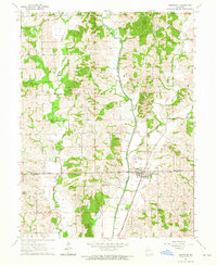
1964 Map of Browning
USGS Topo · Published 1965About this map
Browning sits at the intersection of the Sullivan Co Linn Co line in northern Missouri, serving as a hub for the surrounding agricultural townships of Duncan, Benton, and Jackson. The landscape is deeply carved by Locust Creek and its many tributaries, including West Branch Locust Creek and East Locust Creek. This mid-century survey captures the region's rural character, dominated by family-named cemeteries and community landmarks that speak to generations of local history. Genealogy researchers will find numerous burial sites such as Schrock Cem, McCully Cem, and Hooker Cem. The map also records the Chicago Burlington and Quincy Railroad Grade, illustrating the path of the former rail line as it moved through the terrain near the small settlement of Cora.
Find a feature on this map
26 named features on this map. Tap any name to fly to it.
Don’t see what you’re looking for? This feature index may not catch every label — zoom into the map to look around manually.
Map Details
Editions of this 1964 Browning Map
This is the sole edition of this map. No revisions or reprints were ever made.
Other maps of this area

1924 · Chula
USGS Topo · 1:62,500

1946 · Brookfield
USGS Topo · 1:62,500

1946 · Galt
USGS Topo · 1:62,500

1947 · Chula
USGS Topo · 1:62,500

1948 · Brookfield
USGS Topo · 1:62,500

1949 · Galt
USGS Topo · 1:62,500

1953 · Moberly
USGS Topo · 1:250,000

1954 · Centerville
USGS Topo · 1:250,000

1954 · Moberly
USGS Topo · 1:250,000

1957 · Moberly
USGS Topo · 1:250,000