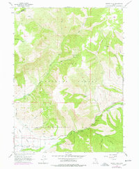
1964 Map of Browns Hole
USGS Topo · Published 1978About this map
Browns Hole and the surrounding drainages of the Cache National Forest are defined by the convergence of mountain forks in the mid-1960s. The landscape is characterized by a network of seasonal camps and public recreation sites, including Meadows Campground and Hobble Campground, which follow the course of the South Fork Ogden River. Water management is evident through features like the Diversion Dam, the South Canal, and a Gaging Station, reflecting the importance of irrigation and flow control to the valley below.
Find a feature on this map
36 named features on this map. Tap any name to fly to it.
Don’t see what you’re looking for? This feature index may not catch every label — zoom into the map to look around manually.
Map Details
Editions of this 1964 Browns Hole Map
2 editions found
Other maps of this area

1954 · Ogden
USGS Topo · 1:250,000

1955 · Huntsville
USGS Topo · 1:24,000

1955 · James Peak
USGS Topo · 1:24,000

1955 · Snow Basin
USGS Topo · 1:24,000

1958 · Ogden
USGS Topo · 1:250,000

1960 · Ogden
USGS Topo · 1:250,000

1961 · Morgan
USGS Topo · 1:62,500

1964 · Monte Cristo PK
USGS Topo · 1:24,000
1964 · Sharp Mountain
USGS Topo · 1:24,000
1964 · Browns Hole
USGS Topo · 1:24,000
Featured Places
- Green Hill Country Estates, UT
- Huntsville Hollow, UT
- Evergreen Park, UT
- Mountain Valley Meadows, UT
- Weber County, UT