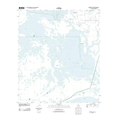
2012 Map of Browns Lake
USGS Topo · Published 2012About this map
The West Hackberry Strategic Petroleum Reserve anchors the industrial landscape of this Cameron Parish coastal region, situated just north of the expansive Browns Lake. The environment is defined by an intricate network of waterways and ridges that rise above the wetlands, including Lost Ridge, Back Ridge, and Hog Island. To the southeast, the shoreline of Calcasieu Lake is visible, connected to the interior marsh by the Shell Canal and Hog Island Gully.
Find a feature on this map
32 named features on this map. Tap any name to fly to it.
Don’t see what you’re looking for? This feature index may not catch every label — zoom into the map to look around manually.
Map Details
Editions of this 2012 Browns Lake Map
This is the sole edition of this map. No revisions or reprints were ever made.
Other maps of this area

1932 · Moss Lake
USGS Topo · 1:31,680

1932 · Orange
USGS Topo · 1:62,500

1934 · Cameron
USGS Topo · 1:24,000

1934 · Holly Beach
USGS Topo · 1:24,000

1934 · Peveto Beach
USGS Topo · 1:24,000

1934 · Browns Lake
USGS Topo · 1:24,000

1934 · Five Lakes
USGS Topo · 1:24,000

1935 · Peveto Beach
USGS Topo · 1:31,680

1935 · Cameron
USGS Topo · 1:31,680

1935 · Five Lakes
USGS Topo · 1:31,680