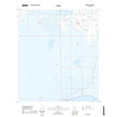
2020 Map of Browns Lake
USGS Topo · Published 2020About this map
The settlement of Hackberry anchors this coastal Louisiana landscape, situated amidst a complex network of wetlands and tidal waters in Cameron Parish. The terrain is defined by low-lying elevations such as Lost Ridge, Back Ridge, and Hog Island, which rise above the surrounding marshes. Industrial and coastal infrastructure is evident through the extensive waterway system, including the Burton Sutton Canal and West Cove Canal, which facilitate movement between Black Lake and West Cove.
Find a feature on this map
30 named features on this map. Tap any name to fly to it.
Don’t see what you’re looking for? This feature index may not catch every label — zoom into the map to look around manually.
Map Details
Editions of this 2020 Browns Lake Map
This is the sole edition of this map. No revisions or reprints were ever made.
Other maps of this area

1932 · Moss Lake
USGS Topo · 1:31,680

1932 · Orange
USGS Topo · 1:62,500

1934 · Cameron
USGS Topo · 1:24,000

1934 · Holly Beach
USGS Topo · 1:24,000

1934 · Peveto Beach
USGS Topo · 1:24,000

1934 · Browns Lake
USGS Topo · 1:24,000

1934 · Five Lakes
USGS Topo · 1:24,000

1935 · Peveto Beach
USGS Topo · 1:31,680

1935 · Cameron
USGS Topo · 1:31,680

1935 · Five Lakes
USGS Topo · 1:31,680