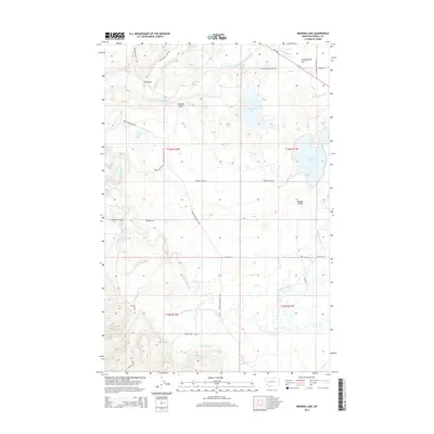
2014 Map of Browns Lake
USGS Topo · Published 2014About this map
Kleinschmidt Flat and the surrounding basin of the North Fork Blackfoot River dominate this Powell County landscape. The map captures a sophisticated network of glacial lakes and water management features, including the prominent Kleinschmidt Lake and the smaller Evans Lake to the north. Evidence of the region's agricultural and ranching infrastructure is visible through names like the Company Ditch and numerous rural roads such as Geary Bros Cabin Rd and Whistler Place Rd. The terrain transitions from the open stretches of Nevada Valley to the riparian corridors of the Blackfoot River, where the Raymond Bridge provides a key crossing. Significant local watercourses including Nevada Creek and Wales Cr drain the southern highlands, illustrating the complex hydrology of this high-elevation valley during the early twenty-first century.
Find a feature on this map
35 named features on this map. Tap any name to fly to it.
Don’t see what you’re looking for? This feature index may not catch every label — zoom into the map to look around manually.
Map Details
Editions of this 2014 Browns Lake Map
This is the sole edition of this map. No revisions or reprints were ever made.
Other maps of this area

1889 · Helena
USGS Topo · 1:250,000

1893 · Helena
USGS Topo · 1:250,000

1899 · Helena
USGS Topo · 1:250,000

1902 · Ovando
USGS Topo · 1:125,000

1903 · Coopers Lake
USGS Topo · 1:125,000

1903 · Helena
USGS Topo · 1:250,000

1905 · Ovando
USGS Topo · 1:125,000

1919 · Drummond
USGS Topo · 1:125,000

1921 · Drummond
USGS Topo · 1:125,000

1947 · Butte
USGS Topo · 1:250,000