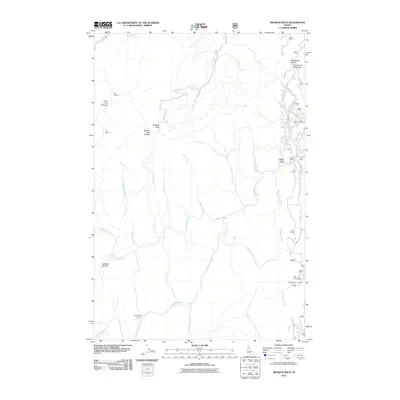
2011 Map of Browns Rock
USGS Topo · Published 2011About this map
Washington Cabin and a series of numbered forest camps define the settlement pattern of this remote Clearwater County landscape. The area is characterized by a dense network of creek drainages, including Washington Creek, Rettig Creek, and Scofield Creek, which carve through the high ground of Scofield Divide and Deadhorse Mountain. These waterways feed into larger systems like Beaver Creek and the East Fork Elk Creek, reflecting a region primarily accessed via forest routes such as Beaver Creek Rd and Browns Rock Rd. Evidence of early 20th-century logging or administrative activity is found in the labels for Old Camp 10, Old Camp 11, and Camp Sixty. At higher elevations, landmarks like Browns Rock and the Elk Mountain Lookout provide strategic vantage points over the heavily dissected terrain.
Find a feature on this map
34 named features on this map. Tap any name to fly to it.
Don’t see what you’re looking for? This feature index may not catch every label — zoom into the map to look around manually.
Map Details
Editions of this 2011 Browns Rock Map
This is the sole edition of this map. No revisions or reprints were ever made.
Other maps of this area

1923 · Washington Creek
USGS Topo · 1:125,000

1936 · Boehls Butte
USGS Topo · 1:48,000

1938 · Headquarters
USGS Topo · 1:48,000

1943 · Boehls Butte
USGS Topo · 1:62,500

1944 · Headquarters
USGS Topo · 1:62,500

1956 · Hamilton
USGS Topo · 1:250,000

1959 · Hamilton
USGS Topo · 1:250,000

1960 · Hamilton
USGS Topo · 1:250,000

1963 · Sheep Mtn
USGS Topo · 1:24,000

1963 · Clarke Mtn
USGS Topo · 1:24,000