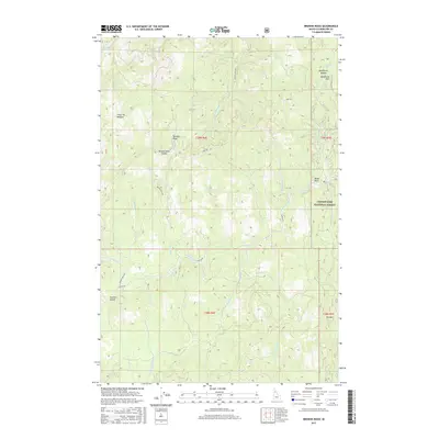
2017 Map of Browns Rock
USGS Topo · Published 2017About this map
Clearwater National Forest land defines this portion of the Idaho panhandle, where a complex network of forest roads and creek drainages connects high summits and saddles. The terrain is marked by distinctive landmarks such as Browns Rock and Elk Mtn, while the timber-and-transit history of the region is evidenced by the presence of Camp Ten Meadow and a series of numbered forest routes like Camp 60 Rd. The drainage patterns are intricate, with Beaver Cr, Washington Cr, and Moose Cr carving through the landscape. This map captures the area as it was managed in the twenty-tens, showing the established system of trails and roads including Co RD 251 and Tepee Rd, which facilitate movement between the various peaks and creek basins.
Find a feature on this map
37 named features on this map. Tap any name to fly to it.
Don’t see what you’re looking for? This feature index may not catch every label — zoom into the map to look around manually.
Map Details
Editions of this 2017 Browns Rock Map
This is the sole edition of this map. No revisions or reprints were ever made.
Other maps of this area

1923 · Washington Creek
USGS Topo · 1:125,000

1936 · Boehls Butte
USGS Topo · 1:48,000

1938 · Headquarters
USGS Topo · 1:48,000

1943 · Boehls Butte
USGS Topo · 1:62,500

1944 · Headquarters
USGS Topo · 1:62,500

1956 · Hamilton
USGS Topo · 1:250,000

1959 · Hamilton
USGS Topo · 1:250,000

1960 · Hamilton
USGS Topo · 1:250,000

1963 · Sheep Mtn
USGS Topo · 1:24,000

1963 · Clarke Mtn
USGS Topo · 1:24,000