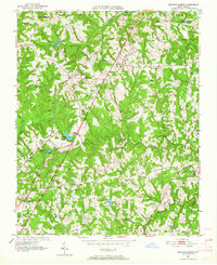
1951 Map of Browns Summit
USGS Topo · Published 1964About this map
Browns Summit serves as a primary hub for this rural portion of Guilford County, situated along the Southern railroad line. The landscape is defined by the winding course of Reedy Fork and numerous small tributaries like Squirrel Creek and Kates Branch. This 1951 topographic survey reveals a community deeply rooted in its local institutions, with an exceptional density of country churches such as Hines Chapel, Lebanon Ch, and Friendship Ch scattered throughout the townships of Monroe and Madison.
Find a feature on this map
40 named features on this map. Tap any name to fly to it.
Don’t see what you’re looking for? This feature index may not catch every label — zoom into the map to look around manually.
Map Details
Editions of this 1951 Browns Summit Map
5 editions found
Other maps of this area

1951 · Lake Brandt
USGS Topo · 1:24,000

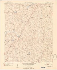
1951 · Browns Summit
USGS Topo · 1:24,000

1951 · Greensboro
USGS Topo · 1:24,000

1952 · Mc Leansville
USGS Topo · 1:24,000

1953 · Greensboro
USGS Topo · 1:250,000

1954 · Greensboro
USGS Topo · 1:250,000

1962 · Greensboro
USGS Topo · 1:250,000

1966 · Greensboro
USGS Topo · 1:250,000

1970 · Gibsonville
USGS Topo · 1:24,000

1970 · Ossipee
USGS Topo · 1:24,000