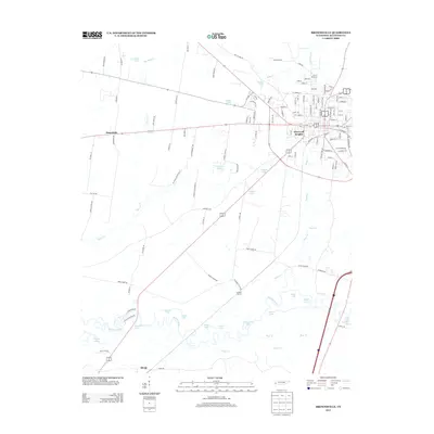
2013 Map of Brownsville
USGS Topo · Published 2013About this map
The Hatchie River dominates the southern landscape of this Haywood County quadrangle, where its meandering path creates a complex network of oxbow lakes including Horseshoe Lake, Swan Lake, and Bullpen Lake. This riverine environment contrasts sharply with the organized street grid of Haywood Heights and the western edge of the county seat. The rural surroundings are defined by long-established crossroads and small clusters such as Macedonia and Shepp. Local transportation and land use are etched into the map through named thoroughfares like Prospect Cemetery Rd and the former rail-associated Cuthbert Switch. The terrain north of the river is dotted with private water bodies like Selaris Lake and Johnson Lake, illustrating a transition from the wilder bottomlands to the managed agricultural and residential lands that define this portion of West Tennessee.
Find a feature on this map
128 named features on this map. Tap any name to fly to it.
Don’t see what you’re looking for? This feature index may not catch every label — zoom into the map to look around manually.
Map Details
Editions of this 2013 Brownsville Map
This is the sole edition of this map. No revisions or reprints were ever made.
Other maps of this area

1950 · Sunnyhill
USGS Topo · 1:24,000

1950 · Brownsville
USGS Topo · 1:24,000

1951 · Brownsville
USGS Topo · 1:24,000

1951 · Sunnyhill
USGS Topo · 1:24,000

1952 · Stanton
USGS Topo · 1:24,000

1952 · Dancyville
USGS Topo · 1:24,000

1952 · Stanton
USGS Topo · 1:62,500

1956 · Blytheville
USGS Topo · 1:250,000

1959 · Blytheville
USGS Topo · 1:250,000

1959 · Hillville
USGS Topo · 1:24,000