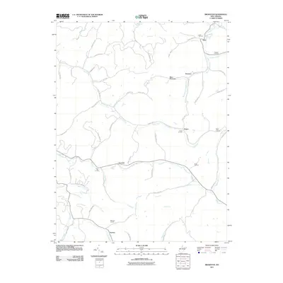
2011 Map of Brownton
USGS Topo · Published 2011About this map
Elk Creek and its many winding tributaries define the rural landscape of this West Virginia interior, where small settlements like Brownton and Peeltree anchor a network of country highways. The terrain is marked by the presence of Bear Mountain and a heavy concentration of ancestral sites, including Astor Cemetery, Mount Tabor Cemetery, and Nutter Cemetery. Transportation through these valleys relies on routes like County Hwy-16 and County Hwy-7, which track alongside the Brushy Fork and other waterways. The inclusion of Rexroad Airport and the Galloway Post Office suggests the local infrastructure serving these spread-out communities. This 2011 record documents a traditional Appalachian settlement pattern where development remains closely tied to the natural drainage systems of Arnold Run, Isaacs Run, and Simpson Creek.
Find a feature on this map
63 named features on this map. Tap any name to fly to it.
Don’t see what you’re looking for? This feature index may not catch every label — zoom into the map to look around manually.
Map Details
Editions of this 2011 Brownton Map
This is the sole edition of this map. No revisions or reprints were ever made.
Other maps of this area

1902 · Clarksburg
USGS Topo · 1:62,500

1902 · Fairmont
USGS Topo · 1:62,500

1904 · Philippi
USGS Topo · 1:62,500

1904 · Weston
USGS Topo · 1:62,500

1910 · Clarksburg
USGS Topo · 1:62,500

1923 · Fairmont
USGS Topo · 1:62,500

1923 · Clarksburg
USGS Topo · 1:62,500

1925 · Clarksburg
USGS Topo · 1:62,500

1925 · Philippi
USGS Topo · 1:62,500

1926 · Fairmont
USGS Topo · 1:62,500