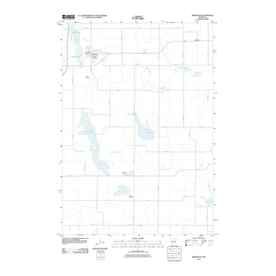
2010 Map of Brownton
USGS Topo · Published 2010About this map
Brownton serves as the primary hub of this McLeod County landscape, situated along the banks of Buffalo Creek. The settlement's civic center is anchored by the Brownton Post Office, while the surrounding rural geography is defined by a dense grid of township roads such as Ridge Rd and Oday Ave. This 2010 survey illustrates the deep-seated community roots through its distribution of family and congregational burial grounds, including Immanuel Cemetery, Streich Cemetery, and Saint Matthew's Cemetery.
Find a feature on this map
37 named features on this map. Tap any name to fly to it.
Don’t see what you’re looking for? This feature index may not catch every label — zoom into the map to look around manually.
Map Details
Editions of this 2010 Brownton Map
This is the sole edition of this map. No revisions or reprints were ever made.
Other maps of this area

1953 · New Ulm
USGS Topo · 1:250,000

1957 · New Ulm
USGS Topo · 1:250,000

1958 · New Ulm
USGS Topo · 1:250,000

1958 · Gaylord
USGS Topo · 1:62,500

1958 · Glencoe
USGS Topo · 1:62,500

1958 · Winthrop
USGS Topo · 1:62,500

1958 · Hutchinson
USGS Topo · 1:62,500

1967 · New Ulm
USGS Topo · 1:250,000
1982 · Heatwole
USGS Topo · 1:24,000
1982 · Biscay
USGS Topo · 1:24,000