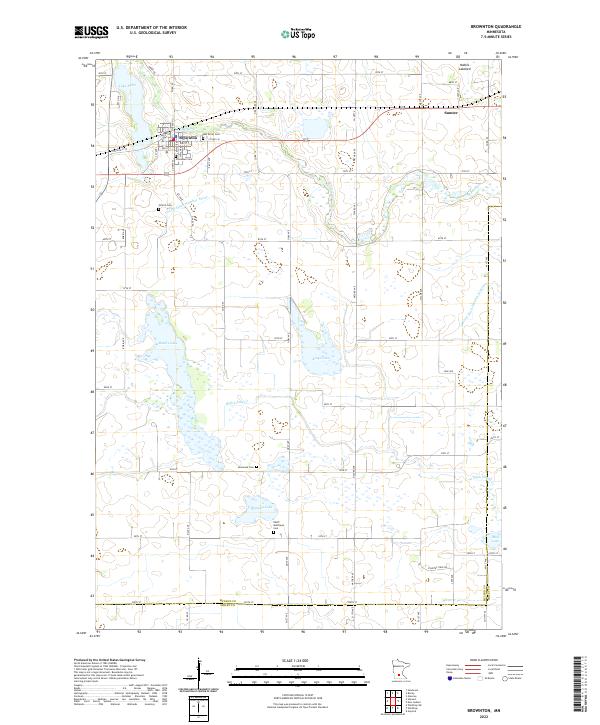
2022 Map of Brownton
USGS Topo · Published 2022About this map
Buffalo Cr meanders across the northern portion of this McLeod County landscape, passing just south of Brownton before continuing east toward Sumter. The terrain is characterized by numerous glacial depressions, including the prominent Lake Addie in the northwest and the expansive Bakers Lake. To the south, High Island Cr drains a series of wetlands and smaller bodies of water like Bremers Lake, eventually crossing the boundary into Sibley County.
Find a feature on this map
74 named features on this map. Tap any name to fly to it.
Don’t see what you’re looking for? This feature index may not catch every label — zoom into the map to look around manually.
Map Details
Editions of this 2022 Brownton Map
This is the sole edition of this map. No revisions or reprints were ever made.
Other maps of this area

1953 · New Ulm
USGS Topo · 1:250,000

1957 · New Ulm
USGS Topo · 1:250,000

1958 · New Ulm
USGS Topo · 1:250,000

1958 · Gaylord
USGS Topo · 1:62,500

1958 · Glencoe
USGS Topo · 1:62,500

1958 · Winthrop
USGS Topo · 1:62,500

1958 · Hutchinson
USGS Topo · 1:62,500

1967 · New Ulm
USGS Topo · 1:250,000
1982 · Heatwole
USGS Topo · 1:24,000
1982 · Biscay
USGS Topo · 1:24,000