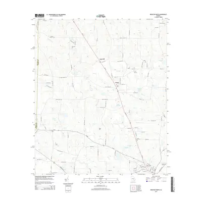
2014 Map of Broxton North
USGS Topo · Published 2014About this map
Broxton sits at the southern edge of this Coffee County landscape, where the street grid gives way to a network of rural routes and family-named landmarks. The terrain is defined by a series of south-flowing drainages, including Seven Cr and Ninemile Cr, which create a complex pattern of wetlands and small lakes such as James Smith Lake and Dockery Pond. For genealogists, the map is particularly dense with burial sites, from the larger Broxton City Cem to smaller family and community plots like De Berry Cem, Benjamin Chapel Cem, and the Candacy Cato Cem. Along the corridor of Highway 441, smaller settlements like Pridgen and the descriptively named Sapps Still appear amidst the timber and agricultural lands. Historically significant thoroughfares, such as Old Coffee Rd, suggest the long-standing transportation patterns that linked these South Georgia communities before modern developments.
Find a feature on this map
99 named features on this map. Tap any name to fly to it.
Don’t see what you’re looking for? This feature index may not catch every label — zoom into the map to look around manually.
Map Details
Editions of this 2014 Broxton North Map
This is the sole edition of this map. No revisions or reprints were ever made.
Other maps of this area

1953 · Waycross
USGS Topo · 1:250,000

1958 · Waycross
USGS Topo · 1:250,000

1971 · Douglas North
USGS Topo · 1:24,000

1971 · Snipesville
USGS Topo · 1:24,000

1971 · Broxton NE
USGS Topo · 1:24,000

1972 · Broxton North
USGS Topo · 1:24,000

1972 · Jacksonville
USGS Topo · 1:24,000

1972 · Ambrose
USGS Topo · 1:24,000

1972 · China Hill
USGS Topo · 1:24,000

1977 · Osierfield
USGS Topo · 1:24,000