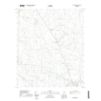
2020 Map of Broxton North
USGS Topo · Published 2020About this map
Broxton and the surrounding agricultural lands of northern Coffee County are defined by a network of family-named settlements and local cemeteries. The landscape is structured by several small drainages, including Ninemile Cr and Seven Cr, which feed into private ponds and lakes such as James Smith Lake and Reynolds Lake. The distribution of burial sites like Benjamin Chapel Cem and De Berry Cem across the rural countryside suggests a long history of family homesteads scattered along roads like Old Coffee Rd. Smaller communities such as Pridgen and Sapps Still serve as local hubs in this timber and farming region. The map reveals the intricate secondary road network connecting these points, including many gravel and dirt routes that remain vital to local transit and property access.
Find a feature on this map
101 named features on this map. Tap any name to fly to it.
Don’t see what you’re looking for? This feature index may not catch every label — zoom into the map to look around manually.
Map Details
Editions of this 2020 Broxton North Map
This is the sole edition of this map. No revisions or reprints were ever made.
Other maps of this area

1953 · Waycross
USGS Topo · 1:250,000

1958 · Waycross
USGS Topo · 1:250,000

1971 · Douglas North
USGS Topo · 1:24,000

1971 · Snipesville
USGS Topo · 1:24,000

1971 · Broxton NE
USGS Topo · 1:24,000

1972 · Broxton North
USGS Topo · 1:24,000

1972 · Jacksonville
USGS Topo · 1:24,000

1972 · Ambrose
USGS Topo · 1:24,000

1972 · China Hill
USGS Topo · 1:24,000

1977 · Osierfield
USGS Topo · 1:24,000