
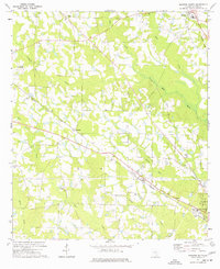
1972 Map of Broxton North
USGS Topo · Published 1975About this map
Broxton anchors the southern portion of this South Georgia landscape in the early 1970s, situated at the intersection of rural highways and the Georgia and Florida Railway line. The town's grid is marked by a Water Tank and the nearby Hayes Sch, reflecting a settled agricultural community. Moving north, the landscape is defined by a dense network of watercourses, including Roses Creek, Reedy Creek, and Ninemile Creek, which cut through the varied elevations near Rose Hill.
Find a feature on this map
28 named features on this map. Tap any name to fly to it.
Don’t see what you’re looking for? This feature index may not catch every label — zoom into the map to look around manually.
Map Details
Editions of this 1972 Broxton North Map
This is the sole edition of this map. No revisions or reprints were ever made.
Other maps of this area

1953 · Waycross
USGS Topo · 1:250,000

1958 · Waycross
USGS Topo · 1:250,000

1971 · Douglas North
USGS Topo · 1:24,000

1971 · Snipesville
USGS Topo · 1:24,000

1971 · Broxton NE
USGS Topo · 1:24,000

1972 · Jacksonville
USGS Topo · 1:24,000

1972 · Ambrose
USGS Topo · 1:24,000

1972 · China Hill
USGS Topo · 1:24,000

1977 · Osierfield
USGS Topo · 1:24,000
1977 · Broxton South
USGS Topo · 1:24,000