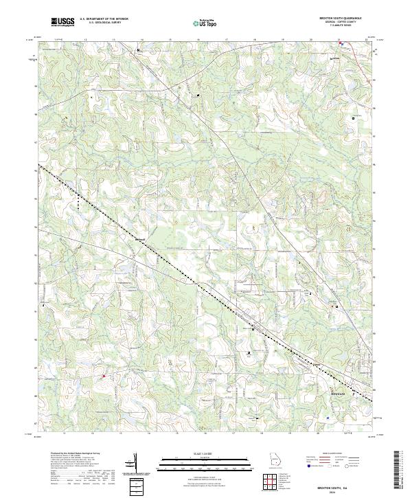
2024 Map of Broxton South
USGS Topo · Published 2024About this map
Seventeen Mile River meanders across this landscape north of Douglas, anchoring a rural network of small communities and family burial grounds in Coffee County. The settlements of Bushnell and Upton represent the agricultural and social hubs of the early 21st century, connected by a dense grid of county roads such as Bowens Mill Rd and Hinson Ln. For local historians and genealogists, this area is particularly noteworthy for its numerous cemeteries, including Bethany Cem, Day Cem, and Rocky Pond Cem, which are scattered throughout the countryside. Waterways like Twenty Mile Creek and Halls Creek define the drainage patterns that have likely influenced land use and farm placement for generations. The map also shows the northern outskirts of the county seat, where residential streets begin to give way to the broader agricultural expanses that characterize the region's interior.
Find a feature on this map
141 named features on this map. Tap any name to fly to it.
Don’t see what you’re looking for? This feature index may not catch every label — zoom into the map to look around manually.
Map Details
Editions of this 2024 Broxton South Map
This is the sole edition of this map. No revisions or reprints were ever made.
Other maps of this area

1953 · Waycross
USGS Topo · 1:250,000

1958 · Waycross
USGS Topo · 1:250,000

1971 · Douglas North
USGS Topo · 1:24,000

1971 · Douglas South
USGS Topo · 1:24,000

1971 · Broxton NE
USGS Topo · 1:24,000

1972 · Broxton North
USGS Topo · 1:24,000

1972 · Lax
USGS Topo · 1:24,000

1972 · Ambrose
USGS Topo · 1:24,000

1972 · Mora
USGS Topo · 1:24,000

1977 · Osierfield
USGS Topo · 1:24,000