
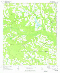
1972 Map of Mora
USGS Topo · Published 1987About this map
The Satilla River carves a winding path through the center of this terrain, its wide floodplain punctuated by wetlands and small tributaries like Reedy Creek and Forky Creek. This 1970s landscape on the boundary of Coffee Co and Atkinson Co reveals a rural Georgia economy rooted in agriculture and timber, with numerous farm structures and fields indicated by the 1987 photogrammetric revisions. The presence of the Sou railroad corridor passing through the settlement of Mora underscores the historic importance of rail transport for moving local goods. Further south, the community of Oberry sits near the headwaters of Dark Bay, while rural spiritual life is documented through several localized landmarks including Hebron Ch, St Elias Ch, and Wesley Chapel. The extensive network of unimproved roads and a Jeep Trail suggests a working landscape deeply tied to the river and its surrounding woods.
Find a feature on this map
22 named features on this map. Tap any name to fly to it.
Don’t see what you’re looking for? This feature index may not catch every label — zoom into the map to look around manually.
Map Details
Editions of this 1972 Mora Map
This is the sole edition of this map. No revisions or reprints were ever made.
Other maps of this area

1953 · Waycross
USGS Topo · 1:250,000

1958 · Waycross
USGS Topo · 1:250,000

1971 · Douglas North
USGS Topo · 1:24,000

1971 · Douglas South
USGS Topo · 1:24,000

1971 · Pearson
USGS Topo · 1:24,000

1972 · Kirkland
USGS Topo · 1:24,000

1972 · Willacoochee
USGS Topo · 1:24,000

1972 · Lax
USGS Topo · 1:24,000

1972 · Ambrose
USGS Topo · 1:24,000
1977 · Mora
USGS Topo · 1:24,000