1977 Map of Mora
USGS Topo · Published 1977About this map
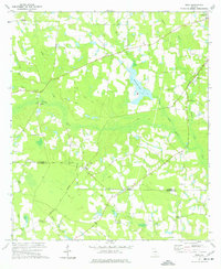
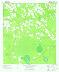
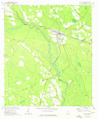
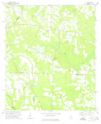
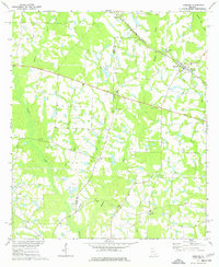
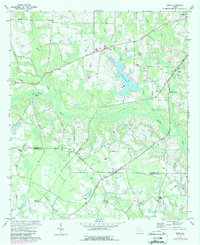
The Satilla River basin defines this 1970s landscape on the border of Coffee and Atkinson Counties, where a network of swampy lowlands like Dark Bay and Hilliards Pond alternates with small agrarian settlements. The Central of Georgia railroad cuts diagonally across the southern half of the sheet, connecting the communities of Mora and Oberry. This area is particularly rich in small country congregations, which likely served as the primary social hubs for the surrounding farmsteads. Several distinct churches are documented here, including Hebron Ch, St Illias Ch, and Wesley Chapel. The terrain is also marked by numerous watercourses such as Reedy Creek, Forky Creek, and Mill Creek, illustrating a rural Georgia environment where transportation followed the higher ground between creek drainages and rail lines.
Find a feature on this map
21 named features on this map. Tap any name to fly to it.
Don’t see what you’re looking for? This feature index may not catch every label — zoom into the map to look around manually.
Map Details
Editions of this 1977 Mora Map
This is the sole edition of this map. No revisions or reprints were ever made.
Other maps of this area

1953 · Waycross
USGS Topo · 1:250,000

1958 · Waycross
USGS Topo · 1:250,000
1971 · Douglas North
USGS Topo · 1:24,000
1971 · Douglas South
USGS Topo · 1:24,000
1971 · Pearson
USGS Topo · 1:24,000
1972 · Kirkland
USGS Topo · 1:24,000
1972 · Willacoochee
USGS Topo · 1:24,000
1972 · Lax
USGS Topo · 1:24,000
1972 · Ambrose
USGS Topo · 1:24,000
1972 · Mora
USGS Topo · 1:24,000