
1972 Map of Kirkland
USGS Topo · Published 1976About this map
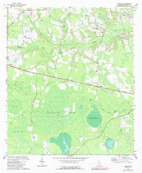
Roundabout Swamp dominates the central landscape of this Atkinson County region, illustrating the intricate hydrology of the Georgia coastal plain in the early 1970s. The Seaboard Coast Line railroad serves as the primary east-west corridor, connecting the small settlements of Kirkland and Leliaton. This rail infrastructure, typical of the era's rural economy, is flanked by several community anchors, including Antioch Ch, Sunnyside Ch, and Bethel Ch.
Find a feature on this map
20 named features on this map. Tap any name to fly to it.
Don’t see what you’re looking for? This feature index may not catch every label — zoom into the map to look around manually.
Map Details
Editions of this 1972 Kirkland Map
2 editions found
Other maps of this area

1953 · Waycross
USGS Topo · 1:250,000

1958 · Waycross
USGS Topo · 1:250,000

1971 · Douglas South
USGS Topo · 1:24,000

1971 · Pearson
USGS Topo · 1:24,000

1972 · Willacoochee
USGS Topo · 1:24,000

1972 · Lax
USGS Topo · 1:24,000

1972 · Sandy Bottom
USGS Topo · 1:24,000

1972 · Henderson Still
USGS Topo · 1:24,000

1972 · Mora
USGS Topo · 1:24,000
1977 · Mora
USGS Topo · 1:24,000