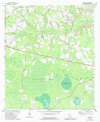
1972 Map of Kirkland
USGS Topo · Published 1987About this map
Kirkland and Leliaton serve as the primary human anchors in this South Georgia landscape, situated along the CSX railroad corridor. The terrain is defined by a complex network of wetlands and water bodies, most notably the expansive Roundabout Swamp which is bisected by an extensive series of ditches. These drainage efforts reflect the intersection of the natural environment with local agricultural and timber management practices typical of Atkinson County.
Find a feature on this map
26 named features on this map. Tap any name to fly to it.
Don’t see what you’re looking for? This feature index may not catch every label — zoom into the map to look around manually.
Map Details
Editions of this 1972 Kirkland Map
2 editions found
Other maps of this area

1953 · Waycross
USGS Topo · 1:250,000

1958 · Waycross
USGS Topo · 1:250,000

1971 · Douglas South
USGS Topo · 1:24,000

1971 · Pearson
USGS Topo · 1:24,000

1972 · Kirkland
USGS Topo · 1:24,000

1972 · Willacoochee
USGS Topo · 1:24,000

1972 · Lax
USGS Topo · 1:24,000

1972 · Sandy Bottom
USGS Topo · 1:24,000

1972 · Henderson Still
USGS Topo · 1:24,000

1972 · Mora
USGS Topo · 1:24,000