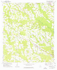
1977 Map of Broxton South
USGS Topo · Published 1977About this map
Ambrose and Bushnell anchor this South Georgia landscape, where the agricultural rhythm of Coffee County is punctuated by rural landmarks and a network of shifting transportation lines. The Seaboard Coast Line runs diagonally through the territory, passing by Upton and several small rural congregations including Salem Ch and Bethany Ch. The map records a transition in mobility, capturing both the active rail corridor and a segment of Old Railroad Grade north of Broxton.
Find a feature on this map
30 named features on this map. Tap any name to fly to it.
Don’t see what you’re looking for? This feature index may not catch every label — zoom into the map to look around manually.
Map Details
Editions of this 1977 Broxton South Map
This is the sole edition of this map. No revisions or reprints were ever made.
Other maps of this area

1953 · Waycross
USGS Topo · 1:250,000

1958 · Waycross
USGS Topo · 1:250,000

1971 · Douglas North
USGS Topo · 1:24,000

1971 · Douglas South
USGS Topo · 1:24,000

1971 · Broxton NE
USGS Topo · 1:24,000

1972 · Broxton North
USGS Topo · 1:24,000

1972 · Lax
USGS Topo · 1:24,000

1972 · Ambrose
USGS Topo · 1:24,000

1972 · Mora
USGS Topo · 1:24,000

1977 · Osierfield
USGS Topo · 1:24,000