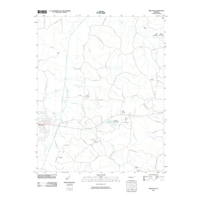
2010 Map of Bruceton
USGS Topo · Published 2010About this map
Bruceton serves as the primary hub of this landscape, situated near the headwaters of several drainages including Cherry Creek and Green Creek. The terrain is characterized by the broad valley of the Big Sandy River, which winds northward through a network of rural roads such as Bruceton-Vale Rd and Old Bruceton Rd. The area's industrial and agricultural history is evident in the water management systems, notably the Hardy Sand Company Lake and C H Sullins Lake, alongside smaller reservoirs like Cole Lake. Genealogists will find a high density of rural burial grounds, ranging from Greer Cemetery in the north to Crossroads Cemetery near Pea Ridge in the south. The settlement of Priests Spur and numerous family-named routes, such as Whitfield Rd and Sawyers Mill Rd, trace the 20th-century development of these communities between the river and the higher ground of the eastern ridges.
Find a feature on this map
69 named features on this map. Tap any name to fly to it.
Don’t see what you’re looking for? This feature index may not catch every label — zoom into the map to look around manually.
Map Details
Editions of this 2010 Bruceton Map
This is the sole edition of this map. No revisions or reprints were ever made.
Other maps of this area

1936 · Camden
USGS Topo · 1:24,000

1936 · Seventeen Creek
USGS Topo · 1:24,000

1936 · Big Sandy
USGS Topo · 1:24,000

1936 · Mansfield
USGS Topo · 1:24,000

1936 · Vale
USGS Topo · 1:24,000

1936 · Bruceton
USGS Topo · 1:24,000

1936 · Buena Vista
USGS Topo · 1:24,000

1936 · Rockport
USGS Topo · 1:24,000

1936 · Manleyville
USGS Topo · 1:24,000

1940 · Manleyville
USGS Topo · 1:24,000