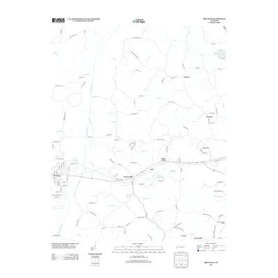
2013 Map of Bruceton
USGS Topo · Published 2013About this map
Bruceton serves as the primary hub in this western Tennessee landscape, where a dense street grid meets the winding course of the Big Sandy River. The map reveals a rural economy shaped by water and small settlements, featuring scattered communities like Prospect, Post Oak, and Sandy Point. The hydrography is particularly detailed, showing a network of named drainages such as Lick Creek, Hunting Creek, and Britton Creek that feed into the river system. Large artificial water bodies like Hardy Sand Company Lake and C H Sullins Lake indicate local industrial or land-management footprints alongside the West Camden Sanitary Landfill. To the east, the terrain transitions into the clustered areas of Pea Ridge and Crossroads, while family-named landmarks like Sawyers Mill and Priests Spur provide valuable geographic markers for those tracing the history of Benton County's rural road networks and early homesteads.
Find a feature on this map
119 named features on this map. Tap any name to fly to it.
Don’t see what you’re looking for? This feature index may not catch every label — zoom into the map to look around manually.
Map Details
Editions of this 2013 Bruceton Map
This is the sole edition of this map. No revisions or reprints were ever made.
Other maps of this area

1936 · Camden
USGS Topo · 1:24,000

1936 · Seventeen Creek
USGS Topo · 1:24,000

1936 · Big Sandy
USGS Topo · 1:24,000

1936 · Mansfield
USGS Topo · 1:24,000

1936 · Vale
USGS Topo · 1:24,000

1936 · Bruceton
USGS Topo · 1:24,000

1936 · Buena Vista
USGS Topo · 1:24,000

1936 · Rockport
USGS Topo · 1:24,000

1936 · Manleyville
USGS Topo · 1:24,000

1940 · Manleyville
USGS Topo · 1:24,000