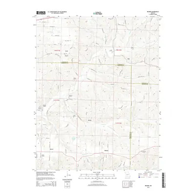
2015 Map of Bruner
USGS Topo · Published 2015About this map
The borderlands of Christian, Webster, and Douglas counties are defined by a network of rural settlements and headwater streams in this 2015 survey. Small communities like Bruner, Elkhead, and Olga anchor the landscape, connected by a dense web of local routes such as Martins Branch Rd and Stewart Creek Rd. The terrain is deeply etched by water, with Finley Creek and Stewart Cr carving through the Ozark topography, while Murphy Pond provides a rare stationary water feature in the southern half of the quadrangle.
Find a feature on this map
85 named features on this map. Tap any name to fly to it.
Don’t see what you’re looking for? This feature index may not catch every label — zoom into the map to look around manually.
Map Details
Editions of this 2015 Bruner Map
This is the sole edition of this map. No revisions or reprints were ever made.
Other maps of this area

1884 · Springfield
USGS Topo · 1:125,000

1886 · Springfield
USGS Topo · 1:125,000

1907 · Forsyth
USGS Topo · 1:125,000

1937 · Bradleyville
USGS Topo · 1:48,000

1937 · Ozark
USGS Topo · 1:48,000

1939 · Fordland
USGS Topo · 1:62,500

1942 · Fordland
USGS Topo · 1:62,500

1943 · Ozark
USGS Topo · 1:62,500

1943 · Bradleyville
USGS Topo · 1:62,500

1945 · Harrison
USGS Topo · 1:250,000