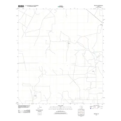
2010 Map of Bruni SE
USGS Topo · Published 2010About this map
Saint Joseph Oil Field and the Yeager Oil Field define the industrial character of this South Texas landscape in Webb County. The map reveals a remote ranching and energy-producing region where human activity is organized around long rural access roads like Chon Ranch Ln and Yeager Ranch Rd. This 2010 survey documents the infrastructure of the local petroleum economy, showing the distribution of the La Fevre Oil Field across the brush country terrain.
Find a feature on this map
11 named features on this map. Tap any name to fly to it.
Don’t see what you’re looking for? This feature index may not catch every label — zoom into the map to look around manually.
Map Details
Editions of this 2010 Bruni SE Map
This is the sole edition of this map. No revisions or reprints were ever made.
Other maps of this area

1939 · Bruni
USGS Topo · 1:62,500

1939 · Randado
USGS Topo · 1:62,500

1940 · Randado
USGS Topo · 1:62,500

1956 · Laredo
USGS Topo · 1:250,000

1967 · Hebbronville NW
USGS Topo · 1:24,000

1967 · Hebbronville
USGS Topo · 1:24,000

1972 · Armstrong Ranch
USGS Topo · 1:24,000

1972 · Albercas Ranch
USGS Topo · 1:24,000

1972 · Bruni SE
USGS Topo · 1:24,000
1972 · Bruni
USGS Topo · 1:24,000