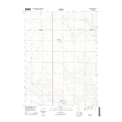
2014 Map of Bruning
USGS Topo · Published 2014About this map
Bruning and Belvidere anchor this agricultural landscape along the Fillmore Co and Thayer Co border. The terrain is defined by the winding paths of Big Sandy Creek and Dry Sandy Creek, which feed into local water features like Hinrichs Reservoir. The regional infrastructure is dominated by the north-south corridor of Us-81, intersecting with state routes like Ne-4 and a rigid grid of section roads that partition the prairie. This layout illustrates the late-twentieth-century evolution of rural Nebraska, where the small-town street plans of E Main St and 7th St contrast with the large-scale irrigation and farming patterns outside the village limits. For those researching local roots, the Keim Cem stands as a primary genealogical landmark west of the main highway.
Find a feature on this map
37 named features on this map. Tap any name to fly to it.
Don’t see what you’re looking for? This feature index may not catch every label — zoom into the map to look around manually.
Map Details
Editions of this 2014 Bruning Map
This is the sole edition of this map. No revisions or reprints were ever made.
Other maps of this area

1898 · Hebron
USGS Topo · 1:125,000

1955 · Lincoln
USGS Topo · 1:250,000

1957 · Lincoln
USGS Topo · 1:250,000

1958 · Lincoln
USGS Topo · 1:250,000

1960 · Bruning
USGS Topo · 1:24,000

1960 · Carleton
USGS Topo · 1:24,000

1960 · Tobias SW
USGS Topo · 1:24,000

1960 · Alexandria
USGS Topo · 1:24,000
1960 · Hebron
USGS Topo · 1:24,000
1960 · Deshler
USGS Topo · 1:24,000