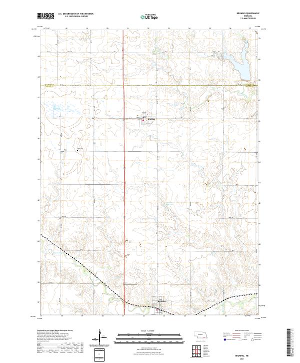
2021 Map of Bruning
USGS Topo · Published 2021About this map
Bruning and Belvidere anchor this central Nebraska landscape, which is defined by the meandering courses of Big Sandy Creek and Dry Sandy Creek. The map documents a predominantly agricultural grid system, where the township boundaries of t5n r3w and t4n r2w meet at the county line between Fillmore County and Thayer County. A notable point for genealogists is the Keim Cemetery, located west of the main north-south corridor. The terrain is relatively flat, punctuated by the Hinrichs Reservoir and subtle elevation changes around the creek beds. This modern survey shows the evolved street plans of the local settlements, including the intersection of Main Street and Voss Street in Bruning, reflecting the enduring layout of these rural communities.
Find a feature on this map
40 named features on this map. Tap any name to fly to it.
Don’t see what you’re looking for? This feature index may not catch every label — zoom into the map to look around manually.
Map Details
Editions of this 2021 Bruning Map
This is the sole edition of this map. No revisions or reprints were ever made.
Other maps of this area

1898 · Hebron
USGS Topo · 1:125,000

1955 · Lincoln
USGS Topo · 1:250,000

1957 · Lincoln
USGS Topo · 1:250,000

1958 · Lincoln
USGS Topo · 1:250,000

1960 · Bruning
USGS Topo · 1:24,000

1960 · Carleton
USGS Topo · 1:24,000

1960 · Tobias SW
USGS Topo · 1:24,000

1960 · Alexandria
USGS Topo · 1:24,000
1960 · Hebron
USGS Topo · 1:24,000
1960 · Deshler
USGS Topo · 1:24,000