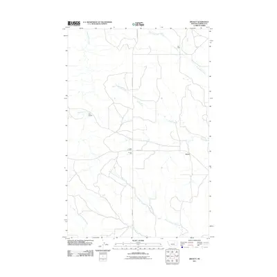
2011 Map of Brusett
USGS Topo · Published 2011About this map
Brusett serves as the quiet center of this Garfield County landscape, marked by the presence of the Brusett Post Office and Fairview Hall along Brusett Rd. This 2011 survey documents a territory defined by its complex drainage systems rather than dense settlement. Waterways like Butts Coulee and Seven Blackfoot Creek carve through the terrain, while the North Fork Lone Tree Creek and East Fork Lone Tree Creek converge in the southern reaches. The area's agricultural reliance on water management is evidenced by the 6M Dam in the north. Secondary roads such as W Snow Creek Rd and Edwards Rd provide the primary connections through this expansive prairie environment, where landforms like Clay Coulee highlight the subtle geological character of eastern Montana.
Find a feature on this map
14 named features on this map. Tap any name to fly to it.
Don’t see what you’re looking for? This feature index may not catch every label — zoom into the map to look around manually.
Map Details
Editions of this 2011 Brusett Map
This is the sole edition of this map. No revisions or reprints were ever made.
Other maps of this area

1954 · Jordan
USGS Topo · 1:250,000

1956 · Jordan
USGS Topo · 1:250,000

1958 · Jordan
USGS Topo · 1:250,000

1964 · Jordan
USGS Topo · 1:250,000

1971 · Hell Hollow
USGS Topo · 1:24,000

1971 · Sawmill Creek
USGS Topo · 1:24,000

1971 · Chalk Butte
USGS Topo · 1:24,000

1978 · Fort Peck Lake West
USGS Topo · 1:100,000

1983 · Steve Forks
USGS Topo · 1:24,000
1983 · Blackfoot School
USGS Topo · 1:24,000