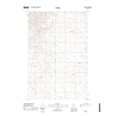
2020 Map of Brusett
USGS Topo · Published 2020About this map
Brusett serves as the primary landmark in this section of Garfield County, marking a remote hub within the vast drainage systems of central Montana. The landscape is defined by its deep, branching coulees and creek beds, most notably Butts Coulee and Clay Coulee, which channel seasonal water toward Smoky Butte Cr. These drainage patterns reflect the essential topography of the Big Dry country, where land use is dictated by the availability of water and the accessibility of range.
Find a feature on this map
15 named features on this map. Tap any name to fly to it.
Don’t see what you’re looking for? This feature index may not catch every label — zoom into the map to look around manually.
Map Details
Editions of this 2020 Brusett Map
This is the sole edition of this map. No revisions or reprints were ever made.
Other maps of this area

1954 · Jordan
USGS Topo · 1:250,000

1956 · Jordan
USGS Topo · 1:250,000

1958 · Jordan
USGS Topo · 1:250,000

1964 · Jordan
USGS Topo · 1:250,000

1971 · Hell Hollow
USGS Topo · 1:24,000

1971 · Sawmill Creek
USGS Topo · 1:24,000

1971 · Chalk Butte
USGS Topo · 1:24,000

1978 · Fort Peck Lake West
USGS Topo · 1:100,000

1983 · Steve Forks
USGS Topo · 1:24,000
1983 · Blackfoot School
USGS Topo · 1:24,000