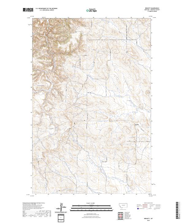
2024 Map of Brusett
USGS Topo · Published 2024About this map
The tiny settlement of Brusett serves as a remote hub in the sprawling Garfield County ranchlands, where the landscape is defined by the winding drainages of Smoky Butte Creek and Lone Tree Coulee. This map documents a high-plains topography of deep coulees and intermittent stream beds that have shaped settlement patterns for generations. To the west, the Loomis & Clark Trl cuts across the terrain, reflecting the historical movement through this isolated part of Montana. Secondary routes like W Snow Creek Rd and Edwards Rd link widely scattered ranch sites across the t20n r35e and t19n r35e townships. The convergence of the North Fork Lone Tree Creek and East Fork Lone Tree Creek highlights the drainage systems that remain critical for local land use in this arid environment.
Find a feature on this map
14 named features on this map. Tap any name to fly to it.
Don’t see what you’re looking for? This feature index may not catch every label — zoom into the map to look around manually.
Map Details
Editions of this 2024 Brusett Map
This is the sole edition of this map. No revisions or reprints were ever made.
Other maps of this area

1954 · Jordan
USGS Topo · 1:250,000

1956 · Jordan
USGS Topo · 1:250,000

1958 · Jordan
USGS Topo · 1:250,000

1964 · Jordan
USGS Topo · 1:250,000

1971 · Hell Hollow
USGS Topo · 1:24,000

1971 · Sawmill Creek
USGS Topo · 1:24,000

1971 · Chalk Butte
USGS Topo · 1:24,000

1978 · Fort Peck Lake West
USGS Topo · 1:100,000

1983 · Steve Forks
USGS Topo · 1:24,000
1983 · Blackfoot School
USGS Topo · 1:24,000