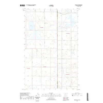
2020 Map of Brush Lake
USGS Topo · Published 2020About this map
Saint Olaf Cem sits atop the high ground between Brush Lake and Twin Lakes, marking a point of spiritual and genealogical significance in this borderland. The landscape is defined by the Dakota Line, where the boundary between Montana and North Dakota separates Sheridan and Williams counties. This 2020 survey reveals a quiet, agrarian region structured by a rigid grid of local roads like Wilson Rd and Syverud Rd. The presence of several distinct water bodies, including the curiously named Stink Lake and the winding course of Willow Cr, suggests a glaciated terrain of prairie potholes and seasonal drainages. For those tracing family roots or land ownership, the map provides a clear view of how the section lines and township markers, such as t33n r58e, organize the remote homesteads and fields across the state line.
Find a feature on this map
28 named features on this map. Tap any name to fly to it.
Don’t see what you’re looking for? This feature index may not catch every label — zoom into the map to look around manually.
Map Details
Editions of this 2020 Brush Lake Map
This is the sole edition of this map. No revisions or reprints were ever made.
Other maps of this area

1946 · Brush Lake
USGS Topo · 1:24,000

1946 · Dagmar
USGS Topo · 1:24,000

1948 · Grenora
USGS Topo · 1:24,000

1948 · Dagmar
USGS Topo · 1:24,000

1948 · Brush Lake
USGS Topo · 1:24,000

1948 · Sunnyhill School
USGS Topo · 1:24,000

1949 · Sunnyhill School
USGS Topo · 1:24,000

1953 · Williston
USGS Topo · 1:250,000

1954 · Wolf Point
USGS Topo · 1:250,000

1957 · Williston
USGS Topo · 1:250,000